I pride myself on staying up-to-the-minute, so in honour of President Carter's
recent negotiation of a peace treaty between Egypt and Israel let's fly
along the Suez Canal in Microsoft Flight Simulator 2020.
Port Said
The white square on the right is unmarked in both Bing and Google Maps,
but it looks to be some kind of military installation - perhaps an
anti-aircraft battery.
I took off from Port Said Airport at the north end of the canal. Port Said's
international airport code is HEPS; HE is the international airport code for
Egypt and presumably PS stands for Port Said. I landed at Ras Sudr, a small
airstrip that just has a number. Judging by Google Maps it's just a strip of
sand and might not even exist any more. In MSFS2020 it doesn't have an air traffic
controller or even a parking area, so I just drove off the runway and parked
in the dirt and tried not to worry about the effect of wind-blown sand on the aircraft's paintwork.
There are no scheduled international flights to Port Said Airport, which is
surprising given that Port Said is Egypt's largest container port. Presumably
people who have business there fly to Cairo and drive or take the train.
Heading south from Port Said
One of MSFS 2020's best features is the weather / time slider, which
changes the weather and time of day in real time. Without it these
screenshots would be mighty dark, because in the real world it was
night-time when I took off.
Egypt and the Suez Canal loom large in the history of the British Empire. They
were our gateways to India and the Far East. After the Second World War our
strategic need for the canal gradually diminished, but it was still important
as a source of ready cash. That lasted until 1956, when the Egyptian
government abruptly nationalised the canal, so we conspired with France and
Israel to stage an invasion and take it back.
On a military level our attack on Port Said was a roaring success. We bombed
the city so hard that it has never threatened British lives ever since. On a
political level however there were quibbles from lefty nay-sayers that Egypt
had not attacked us; that our plans for the Middle East were fanciful dreams
that we didn't have the resources to implement; that by ostensibly trying to
ward off Soviet influence we were only encouraging the USSR to intervene in
the region; that we had killed several thousand innocent Egyptian civilians
for essentially a bit of cash; that we were throwing around weight we no longer had; that the world had changed etc.
Ultimately the United States told us to knock off the invasion and call a
cease-fire, which we did, and the canal has been under Egyptian control ever
since. Britain and the other European powers withdrew from the Middle East,
leaving the region in a state of blissful peace that persists to this day.
Nowadays the Suez Canal is managed by the Suez Canal Authority, which earns
over $5bn a year from tariffs. I learn from the internet that it costs
$250,000 to sail a ship through the canal, so I ever find myself in a Brewster's Millions situation where I need to squander huge amounts of money, the Suez Canal is a good start.
Can you fly over the Suez Canal in real life? It's a major
strategic waterway so my hunch is no, not in a million years, unless you're pally with the Egyptian government, and even then I'd be wary of being accidentally shot down.
This is the Al-Salam Bridge, which is near the northern end of the canal.
It's a joint Japanese-Egyptian project built as part of an attempt by
Egypt to drum up investment in the Sinai Peninsula. The Sinai Peninsula is
bigger than Milton Keynes and also has a population bigger than Milton
Keynes.
The Suez Crisis is fascinating if you're interested in conspiracy theories.
On the one hand it was real. An actual multi-national conspiracy. It actually happened. On the other hand the conspiracy
was uncovered almost immediately, and it failed, which is awkward because conspiracy theorists are
convinced that conspiracies never unravel. They would probably argue that an even larger and more hidden conspiracy drove Britain and France to ruin in order to strengthen the United States' hegemony, but that
way madness lies.
To complicate matters the United States' objection to the invasion was at
least partially on moral grounds, which goes against the general view held
by conspiracy theorists that the United States is evil, or that the hidden
government that runs the United States is evil, or that the ancient hidden
conspiracy behind the hidden government that runs the United States is evil
etc.
And that bit about Milton Keynes came out wrong. The Sinai Peninsula is huge but has a very small population of only 600,000 or so. The central section has a road and some mountains but nothing else.
It would be an awesome filming location if you could get there. Israel
occupied the peninsula during the 1970s but failed to make anything of it. Egypt has spent a lot of money since then trying to make the coastal parts
tourist destinations. The middle section is inhabited by Bedouin, who are probably sick of Instagram travel bloggers - the woman is a marketing executive, the man a former hedge fund manager - using them as photographic backdrops.
About six months after writing this post I visited the Revoltella Museum in Trieste, Italy, which had a little exhibit about the Suez canal - including this excellent painting by Albert Rieger, which was created in 1864, just as construction began.
Imagine if Egypt found oil in the Sinai! Actually, no, that would be terrible. For the Bedouin, anyway. They would be forcibly moved away and replaced by imported workers, so they wouldn't benefit at all.
I really need to clean the window.
MSFS2020 seems to be slightly flummoxed by the flat, almost monochrome textures of the local area; some parts of the eastern bank in particular look very rough.
For the trip I flew a Diamond DA-62, a light twin that has become one of my
favourite aircraft in MSFS2020. It has enough range to go on long trips, the
autopilot is easy to use, the cockpit is laid out sensibly and it looks neat.
The game draws its imagery from Bing Maps. It's interesting to compare it with
Google's aerial footage. The three circular fields in the image above are just
sand on Google maps, perhaps because the photographs were taken in a different
part of the year.
Why are the fields circular? It's a thing called
centre-pivot irrigation. In the middle of the field there's a water
pipe that connects to a big long hose held up on a metal framework that goes
round and around, irrigating the field. You learn something every day.
I flew over Ismailia, which is on the north bank of Lake Timsah, one of the
small salty lakes along the Suez Canal that are used as passing places for
ships. Modern-day Ismailia exists because of the canal; it was essentially a big
dormitory for the workers who built it. It's the terminus of the Ismailia canal, which connects Ismailia with Cairo, to the west. The Ismailia canal was built in the early 1860s to provide the workers with fresh water. It's easily visible on Google Maps as a strip of green heading east from Cairo. Perhaps one day, when the world has got better, I might stroll along its
banks.
This airport is south of the city. As you might expect from the
compartmentalised aircraft bunkers it's a military airbase. MSFS2020
identifies it as Ismailia Airport, but it's actually called Deversoir,
formerly RAF Deversoir. I learn from this Pathé news bulletin that it was
pronounced dev-ah-swoir, and in the 1950s it had Vampires (the aircraft,
not the supernatural beings):
The rest of the clip paints a surprisingly bleak view of Britain's time in
Egypt. The canal is said to be in a state of siege from terrorists, with a
£100 reward for the killing of a British officer, and "intimidation has forced
most of the Egyptian workers to leave British work in the zone".
We originally
ran the whole country, but by the 1950s we had withdrawn to the canal zone. We left in 1956, and to the
surprise of no-one Egypt seized the canal, hence the unpleasantness described
above. Part of our justification for military action was the fear that Egypt would run the canal into the ground, but we obviously underestimated them because it continues to function to this day.
Immediately south of Deversoir is the Great Bitter Lake, which
goes well with vodka is very salty:
The lake is almost entirely dead, on account of the salt - twice the level of
the open sea - and also pollution from the constant ship traffic. Furthermore
there's a power station on the north-west bank.
Can you swim in it?
Apparently not, or at least not without being arrested. Before the canal existed the lake was
just a big sandy basin, which raises the question of whether any Victorian-era
photographers captured the moment that water flooded into it. If they did I
am not aware of them.
In the 1960s Israel and Egypt had a falling-out, and as a
result the canal was closed from 1967 to 1975. The
fourteen ships passing through the canal ended up stuck in the Bitter Lake. Luckily the crews were allowed to leave,
and over the next eight years replacement skeleton crews were flown in on a rota system,
staffing the ships for months at a time as they baked in the sun. Apart from
the risk of being bombed or sunk by commandos or having unused ordnance dumped
on their heads from aircraft returning to base I imagine it was a relatively
cushy post.
And that's the Bitter Lake. As mentioned in the link above it's a major piece
of strategic infrastructure, but there do appear to be a bunch of beach resorts on the western bank. On the one hand Great Bitter Lake doesn't sound an inviting name, but loads of people flock to the Dead Sea, so who am I?
Visible in the distance is Jebel Ataqah, the only mountain range for miles around.
The Bitter Lake is two-thirds of the way down the canal, so we're on the final
stretch. Port Suez itself was badly damaged during the conflicts of the 1960s and 1970s and was one of the flashpoints for the 2011
Egyptian revolution, but it looks pleasant enough on Google Street View. It's
three hours from Cairo by train, so you could take a day-trip just to say
you've seen the Gulf of Suez.
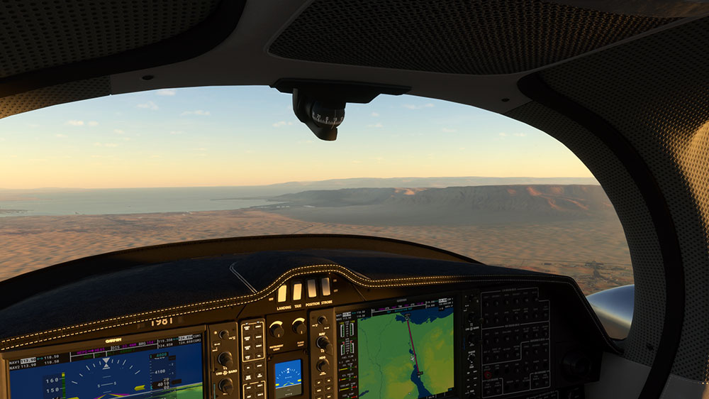
The southern end of the canal
And that's the Suez Canal. An awkward tourist destination in real life, but
easily-navigable by air on account of the fact that the terrain is flat and it's only 120 miles long.
It connects the Arabian Sea to the Mediterranean and is the fastest way to
transport natural resources from Malaysia to Britain by sea, which is one of the
reasons it was built in the first place.
Sometimes MSFS2020 goes odd. This blocky little fort doesn't appear on
Bing Maps, and there's nothing that looks like a fort in that location, or
indeed anything - the bay appears to be deserted.
As mentioned up the page Ras Sudr is just a strip of sand that doesn't appear
to exist any more. Bing and Google Maps both show the runway, but it's
surrounded by beach resorts, so perhaps it's only an emergency landing strip.
As a British person I find it hard not to pronounce Suez as
"Syue-wezzz", and it immediately puts me in mind of Madness' "Night Boat to
Cairo". Will I ever go there in real life? Who knows. The entire continent of
Africa
is bigger than Milton Keynes and has had more COVID-related deaths than
Milton Keynes
has had one-third as many COVID deaths as Britain, despite having a population
twenty-two times greater and a land area unfathomably larger, so props to
Africa. But will they want me?